
大溪河镇 topographic map
Interactive map
Click on the map to display elevation.
About this map
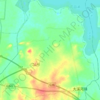
Name: 大溪河镇 topographic map, elevation, terrain.
Location: 大溪河镇, 凤阳县, Chuzhou, Anhui, China (32.88122 117.72102 32.98336 117.84125)
Average elevation: 75 ft
Minimum elevation: 33 ft
Maximum elevation: 174 ft