
Jackson topographic map
Interactive map
Click on the map to display elevation.
About this map
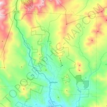
Name: Jackson topographic map, elevation, terrain.
Location: Jackson, Carroll County, New Hampshire, 03846, United States (44.12410 -71.30601 44.24422 -71.09750)
Average elevation: 1,972 ft
Minimum elevation: 541 ft
Maximum elevation: 4,656 ft