
Pennewitz topographic map
Interactive map
Click on the map to display elevation.
About this map
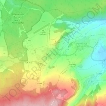
Name: Pennewitz topographic map, elevation, terrain.
Location: Pennewitz, Ilmenau, Ilm-Kreis, Thüringen, 98708, Deutschland (50.64256 11.02951 50.67956 11.06661)
Average elevation: 1,545 ft
Minimum elevation: 1,220 ft
Maximum elevation: 1,969 ft
Ortsteile: Bücheloh | Frauenwald mit Allzunah | Gehren | Gräfinau-Angstedt mit Annawerk und Lehmannsbrück | Heyda | Ilmenau | Jesuborn | Langewiesen | Manebach | Möhrenbach | Oehrenstock | Oberpörlitz | Pennewitz mit Sorge | Roda | Stützerbach | Unterpörlitz | Wümbach Weitere Stadtteile: Campus | Eichicht | Gabelbach | Grenzhammer | Kurviertel | Neuhaus | Pörlitzer Höhe | Stollen