
Edinburgh of the Seven Seas topographic map
Interactive map
Click on the map to display elevation.
About this map
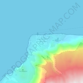
Name: Edinburgh of the Seven Seas topographic map, elevation, terrain.
Average elevation: 604 ft
Minimum elevation: 0 ft
Maximum elevation: 3,543 ft
The archipelago has a wet oceanic climate under the Köppen system with mild temperatures, but consistent moderate to heavy rainfall and very limited sunshine, due to the persistent westerly winds. Under the Trewartha classification, Tristan da Cunha is a humid subtropical climate due to the lack of cold weather. The number of rainy days is comparable to the Aleutian Islands at a much higher latitude in the northern hemisphere, while sunshine hours are comparable to Juneau, Alaska, 20° farther from the equator. Frost is unknown below elevations of 500 metres (1,600 ft) and summer temperatures are similarly mild, never reaching 25 °C (77 °F). Sandy Point on the east coast is reputed to be the warmest and driest place on the island, being in the lee of the prevailing winds.