
Calcinere topographic map
Interactive map
Click on the map to display elevation.
About this map
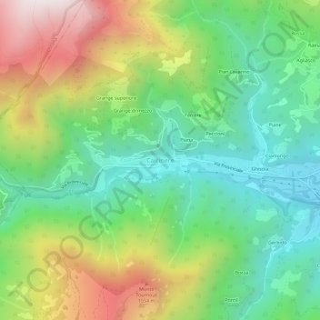
Name: Calcinere topographic map, elevation, terrain.
Location: Calcinere, Paesana, Cuneo, Piemonte, 12034, Italia (44.66731 7.21709 44.70731 7.25709)
Average elevation: 3,527 ft
Minimum elevation: 2,073 ft
Maximum elevation: 6,047 ft
Other topographic maps
Click on a map to view its topography, its elevation and its terrain.
Borgata Beitoni
Italia > Piemonte > Calcinere > Grange superiore
Borgata Beitoni, Grange superiore, Calcinere, Paesana, Cuneo, Piemonte, 12034, Italia
Average elevation: 3,615 ft