Cochacasa topographic map
Interactive map
Click on the map to display elevation.
About this map
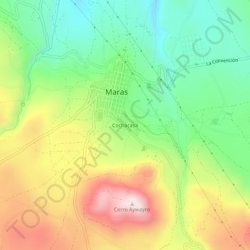
Name: Cochacasa topographic map, elevation, terrain.
Average elevation: 11,184 ft
Minimum elevation: 10,479 ft
Maximum elevation: 12,159 ft

Click on the map to display elevation.
Name: Cochacasa topographic map, elevation, terrain.
Average elevation: 11,184 ft
Minimum elevation: 10,479 ft
Maximum elevation: 12,159 ft