
Borgo Trento topographic map
Interactive map
Click on the map to display elevation.
About this map
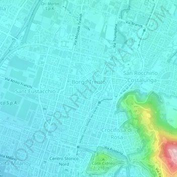
Name: Borgo Trento topographic map, elevation, terrain.
Location: Borgo Trento, Zona Nord, Brescia, BS, Lombardy, 25128, Italy (45.54802 10.21713 45.55940 10.22811)
Average elevation: 571 ft
Minimum elevation: 469 ft
Maximum elevation: 1,348 ft
Other topographic maps
Click on a map to view its topography, its elevation and its terrain.