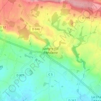
Juvigny-sous-Andaine topographic map
Interactive map
Click on the map to display elevation.
About this map
Name: Juvigny-sous-Andaine topographic map, elevation, terrain.
Average elevation: 584 ft
Minimum elevation: 407 ft
Maximum elevation: 866 ft

Click on the map to display elevation.
Name: Juvigny-sous-Andaine topographic map, elevation, terrain.
Average elevation: 584 ft
Minimum elevation: 407 ft
Maximum elevation: 866 ft