澳貝村 O Pui Village topographic map
Interactive map
Click on the map to display elevation.
About this map
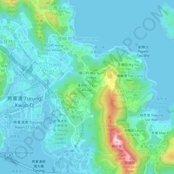
Name: 澳貝村 O Pui Village topographic map, elevation, terrain.
Average elevation: 171 ft
Minimum elevation: -7 ft
Maximum elevation: 1,017 ft

Click on the map to display elevation.
Name: 澳貝村 O Pui Village topographic map, elevation, terrain.
Average elevation: 171 ft
Minimum elevation: -7 ft
Maximum elevation: 1,017 ft