阿坝县 རྔ་བ། topographic map
Interactive map
Click on the map to display elevation.
About this map
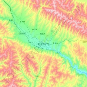
Name: 阿坝县 རྔ་བ། topographic map, elevation, terrain.
Average elevation: 12,283 ft
Minimum elevation: 10,433 ft
Maximum elevation: 14,715 ft

Click on the map to display elevation.
Name: 阿坝县 རྔ་བ། topographic map, elevation, terrain.
Average elevation: 12,283 ft
Minimum elevation: 10,433 ft
Maximum elevation: 14,715 ft