
Bad Zwischenahn topographic map
Interactive map
Click on the map to display elevation.
About this map
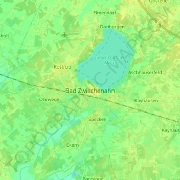
Name: Bad Zwischenahn topographic map, elevation, terrain.
Average elevation: 30 ft
Minimum elevation: -10 ft
Maximum elevation: 56 ft
Other topographic maps
Click on a map to view its topography, its elevation and its terrain.
Wiefelstede
Duitsland > Nedersaksen > Landkreis Ammerland > Wiefelstede
Wiefelstede, Landkreis Ammerland, Nedersaksen, 26215, Duitsland
Average elevation: 36 ft