Geolocate

Lauw topographic map

Click on the map to display elevation.

About this map

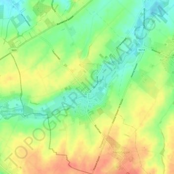
Name: Lauw topographic map, elevation, terrain.

Location: Lauw, Tongeren, Limburg, Flanders, Belgium (50.72280 5.38897 50.75892 5.43293)

Average elevation: 361 ft

Minimum elevation: 282 ft

Maximum elevation: 440 ft

Gear up for your next adventure:

🔭Compact Binoculars - HD vision for scouting terrain and identifying distant landmarks
📌Outdoor GPS Map App - Apps and devices for digital topographic navigation
🛡️Insect Repellent - Protection against bugs during outdoor activities
🛏️Cold Weather Sleeping Bag - Warm sleeping bag for cold conditions
🧭Compass with Lanyard - Easy‑carry compass for navigation

As an Amazon Associate, this site earns from qualifying purchases at no extra cost to you.