
Farooqnagar topographic map
Interactive map
Click on the map to display elevation.
About this map
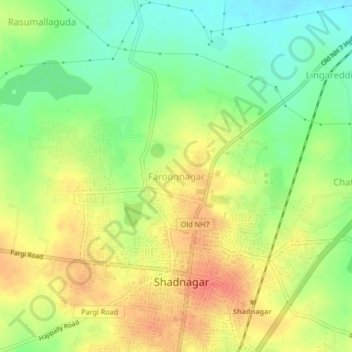
Name: Farooqnagar topographic map, elevation, terrain.
Average elevation: 2,083 ft
Minimum elevation: 1,998 ft
Maximum elevation: 2,165 ft
Other topographic maps
Click on a map to view its topography, its elevation and its terrain.
Shadnagar
India > Telangana > Farooqnagar mandal
Shadnagar, Farooqnagar mandal, Ranga Reddy District, Telangana, 509216, India
Average elevation: 2,073 ft