
Hòn Phụ Tử topographic map
Interactive map
Click on the map to display elevation.
About this map
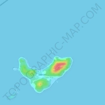
Name: Hòn Phụ Tử topographic map, elevation, terrain.
Location: Hòn Phụ Tử, Kiên Giang Province, Vietnam (10.32272 104.33196 10.32360 104.33277)
Average elevation: 7 ft
Minimum elevation: 0 ft
Maximum elevation: 236 ft
Other topographic maps
Click on a map to view its topography, its elevation and its terrain.
U Minh Thuong National Park
Vietnam > Kien Giang Province > U Minh Thượng District > Xã An Minh Bắc
Average elevation: 7 ft