
Glenwood topographic map
Interactive map
Click on the map to display elevation.
About this map
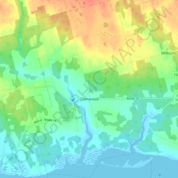
Name: Glenwood topographic map, elevation, terrain.
Location: Glenwood, Lot 8, Prince County, Prince Edward Island, Canada (46.62032 -64.33998 46.67881 -64.27652)
Average elevation: 52 ft
Minimum elevation: -7 ft
Maximum elevation: 151 ft