
Sluiskil topographic map
Interactive map
Click on the map to display elevation.
About this map
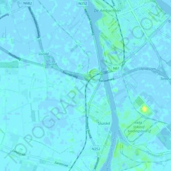
Name: Sluiskil topographic map, elevation, terrain.
Location: Sluiskil, Terneuzen, Seeland, Niederlande (51.26567 3.79362 51.31362 3.87855)
Average elevation: 3 ft
Minimum elevation: -20 ft
Maximum elevation: 56 ft
Other topographic maps
Click on a map to view its topography, its elevation and its terrain.
Overslag
Niederlande > Seeland > Terneuzen
Overslag, Terneuzen, Seeland, Niederlande
Average elevation: 7 ft
Biervliet
Niederlande > Seeland > Terneuzen
Biervliet, Terneuzen, Seeland, Niederlande
Average elevation: 0 ft
Zaamslag
Niederlande > Seeland > Terneuzen
Zaamslag, Terneuzen, Seeland, Niederlande
Average elevation: 0 ft