Geolocate

Maghaway topographic map

Click on the map to display elevation.

About this map

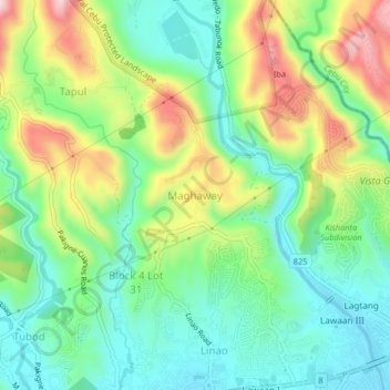
Name: Maghaway topographic map, elevation, terrain.

Location: Maghaway, Talisay, Cebu, Central Visayas, 6045, Philippines (10.25824 123.79617 10.29824 123.83617)

Average elevation: 400 ft

Minimum elevation: 23 ft

Maximum elevation: 1,093 ft

Gear up for your next adventure:

🛶Inflatable Kayak - Portable kayak for rivers, lakes, and expeditions
🏔️Mountain Trail Maps - High‑detail maps for popular peaks
🥤Water Filter Bottle - All‑in‑one filter bottle for safe hydration
🔭Stargazing Telescopes - Perfect for camping in low-light pollution areas shown on maps
👓Polarized Sunglasses - Outdoor sunglasses for glare reduction

As an Amazon Associate, this site earns from qualifying purchases at no extra cost to you.