
Espy topographic map
Interactive map
Click on the map to display elevation.
About this map
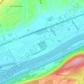
Name: Espy topographic map, elevation, terrain.
Location: Espy, Columbia County, Pennsylvania, United States (40.99669 -76.43527 41.01490 -76.39783)
Average elevation: 587 ft
Minimum elevation: 449 ft
Maximum elevation: 1,079 ft