
Nationalpark Virunga topographic map
Interactive map
Click on the map to display elevation.
About this map
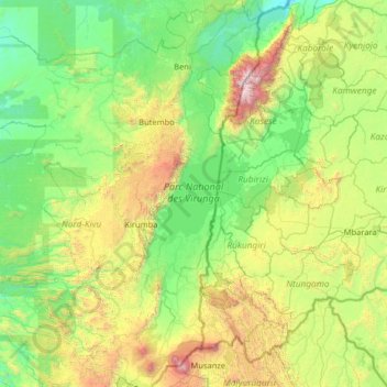
Name: Nationalpark Virunga topographic map, elevation, terrain.
Location: Nationalpark Virunga, Kirumba, Lubero, Nordkivu, 256, DR Kongo (-1.64963 29.02635 0.93431 30.00396)
Average elevation: 4,482 ft
Minimum elevation: 2,116 ft
Maximum elevation: 16,066 ft
Other topographic maps
Click on a map to view its topography, its elevation and its terrain.