
Candanchú topographic map
Interactive map
Click on the map to display elevation.
About this map
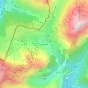
Name: Candanchú topographic map, elevation, terrain.
Location: Candanchú, Aísa, Jacétanie, Aragon, 22889, Espagne (42.76536 -0.54665 42.80536 -0.50665)
Average elevation: 5,531 ft
Minimum elevation: 4,078 ft
Maximum elevation: 7,474 ft