
Thank you for supporting this site ❤️
Make a donation
Make a donation
Gear up for your next adventure:
As an Amazon Associate, this site earns from qualifying purchases at no extra cost to you.
Soest topographic map
Click on the map to display elevation.
Thank you for supporting this site ❤️
Make a donation
Make a donation
Gear up for your next adventure:
As an Amazon Associate, this site earns from qualifying purchases at no extra cost to you.
About this map
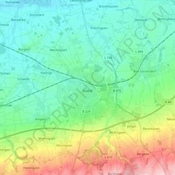
Name: Soest topographic map, elevation, terrain.
Location: Soest, Kreis Soest, North Rhine-Westphalia, 59494, Germany (51.52147 7.98314 51.62756 8.17620)
Average elevation: 397 ft
Minimum elevation: 220 ft
Maximum elevation: 879 ft
Thank you for supporting this site ❤️
Make a donation
Make a donation
Gear up for your next adventure:
As an Amazon Associate, this site earns from qualifying purchases at no extra cost to you.