
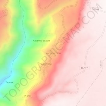
Yarabamba topographic map
Interactive map
Click on the map to display elevation.
About this map
Name: Yarabamba topographic map, elevation, terrain.
Location: Yarabamba, Provincia de Candarave, Tacna, Perú (-17.27559 -70.36343 -17.23559 -70.32343)
Average elevation: 11,857 ft
Minimum elevation: 9,705 ft
Maximum elevation: 12,877 ft