
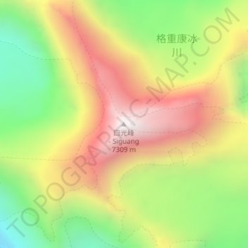
Siguang Ri topographic map
Interactive map
Click on the map to display elevation.
About this map
Name: Siguang Ri topographic map, elevation, terrain.
Average elevation: 21,781 ft
Minimum elevation: 19,823 ft
Maximum elevation: 23,780 ft
Other topographic maps
Click on a map to view its topography, its elevation and its terrain.
चोयु ཇོ་བོ་དབུ་ཡ 卓奧有山 Cho Oyu
चोयु ཇོ་བོ་དབུ་ཡ 卓奧有山 Cho Oyu, 扎西宗乡, དིང་རི་རྫོང་ / 定日县 / Tingri, གཞིས་ཀ་རྩེ་ས་ཁུལ་ / 日喀则市 / Shigatse, Tibet, China
Average elevation: 24,085 ft