
Thank you for supporting this site ❤️
Make a donation
Make a donation
Gear up for your next adventure:
As an Amazon Associate, this site earns from qualifying purchases at no extra cost to you.
Serra d'El-Rei topographic map
Click on the map to display elevation.
Thank you for supporting this site ❤️
Make a donation
Make a donation
Gear up for your next adventure:
As an Amazon Associate, this site earns from qualifying purchases at no extra cost to you.
About this map
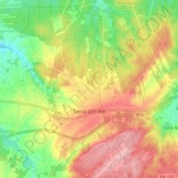
Name: Serra d'El-Rei topographic map, elevation, terrain.
Location: Serra d'El-Rei, Peniche, Leiria, Portugal (39.31102 -9.28898 39.36828 -9.25643)
Average elevation: 292 ft
Minimum elevation: 46 ft
Maximum elevation: 531 ft
Thank you for supporting this site ❤️
Make a donation
Make a donation
Gear up for your next adventure:
As an Amazon Associate, this site earns from qualifying purchases at no extra cost to you.