
Grüna topographic map
Interactive map
Click on the map to display elevation.
About this map
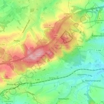
Name: Grüna topographic map, elevation, terrain.
Location: Grüna, Chemnitz, Saksen, 09224, Duitsland (50.80328 12.72753 50.85071 12.81369)
Average elevation: 1,263 ft
Minimum elevation: 1,047 ft
Maximum elevation: 1,575 ft
Other topographic maps
Click on a map to view its topography, its elevation and its terrain.