
Wimmertingen topographic map
Interactive map
Click on the map to display elevation.
About this map
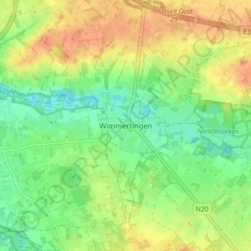
Name: Wimmertingen topographic map, elevation, terrain.
Location: Wimmertingen, Hasselt, Limburg, Vlaanderen, 3501, België (50.86298 5.33177 50.90298 5.37177)
Average elevation: 154 ft
Minimum elevation: 89 ft
Maximum elevation: 220 ft