
Moat topographic map
Interactive map
Click on the map to display elevation.
About this map
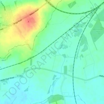
Name: Moat topographic map, elevation, terrain.
Average elevation: 56 ft
Minimum elevation: 3 ft
Maximum elevation: 174 ft
Other topographic maps
Click on a map to view its topography, its elevation and its terrain.
Caistor
United Kingdom > England > West Lindsey > Caistor
Caistor, West Lindsey, Lincolnshire, East Midlands, England, LN7 6UU, United Kingdom
Average elevation: 266 ft
Grasby
United Kingdom > England > West Lindsey > Grasby
Grasby, West Lindsey, Lincolnshire, East Midlands, England, DN38 6AS, United Kingdom
Average elevation: 154 ft
Bigby
United Kingdom > England > West Lindsey > Bigby
Bigby, West Lindsey, Lincolnshire, East Midlands, England, DN38 6EP, United Kingdom
Average elevation: 128 ft