Geolocate

Pangoa topographic map

Click on the map to display elevation.

About this map

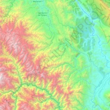
Name: Pangoa topographic map, elevation, terrain.

Location: Pangoa, Province of Satipo, Junín, Peru (-12.19335 -74.72973 -11.31751 -73.98498)

Average elevation: 5,768 ft

Minimum elevation: 1,037 ft

Maximum elevation: 16,900 ft

Other topographic maps

Click on a map to view its topography, its elevation and its terrain.

Cañete

Peru > Junín > Mazamari

Average elevation: 2,418 ft

Gear up for your next adventure:

🌄Hiking Binoculars - Compact binoculars for scenic views and trail spotting
🪶Trail Camera - Capture wildlife on your hikes
🧦Merino Wool Socks - Moisture-wicking, blister-preventing socks for long treks
🎒Gear Packing Cubes - Organize your backpack efficiently
📚USA Hiking Guide Books - Top trail guides and map books

As an Amazon Associate, this site earns from qualifying purchases at no extra cost to you.