Roxas topographic map
Click on the map to display elevation.
Roxas
The landscape of Roxas is relatively compose of flatlands with minimal rise at certain point with base mountain elevations on the eastern part, on the parts of Sinamar, Simimbaan and San Placido. It is approximately 90% of the land area comprising the town can be described as low-lying hills with rolling terrain and an elevation of 200 feet or 61 meters above sea level. The town is dissected by creeks, river and waterways acting as natural drainage from waters coming from the uplands. The Siffu River, a connection from Ilog ng Cagayan(Cagayan River) traverse west ward from its diversion from Paracelis to Tuguegarao City supplying the rice fields with irrigation.
About this map
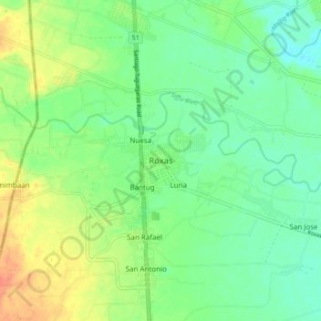
Name: Roxas topographic map, elevation, terrain.
Location: Roxas, Isabela, Cagayan Valley, 3320, Philippines (17.08192 121.57992 17.16192 121.65992)
Average elevation: 194 ft
Minimum elevation: 138 ft
Maximum elevation: 282 ft
Other topographic maps
Click on a map to view its topography, its elevation and its terrain.