
Carew topographic map
Interactive map
Click on the map to display elevation.
About this map
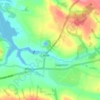
Name: Carew topographic map, elevation, terrain.
Location: Carew, Pembrokeshire, Wales, SA70 8SL, United Kingdom (51.68035 -4.84449 51.72035 -4.80449)
Average elevation: 102 ft
Minimum elevation: -56 ft
Maximum elevation: 269 ft