
Eth Pradet topographic map
Interactive map
Click on the map to display elevation.
About this map
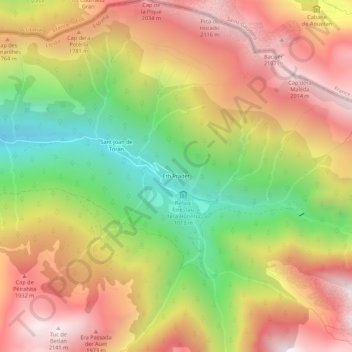
Name: Eth Pradet topographic map, elevation, terrain.
Location: Eth Pradet, Canejan, Val-d'Aran, Catalogne, 25548, Espagne (42.80041 0.78551 42.84041 0.82551)
Average elevation: 5,125 ft
Minimum elevation: 2,917 ft
Maximum elevation: 7,083 ft