
Saint-Germain topographic map
Interactive map
Click on the map to display elevation.
About this map
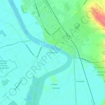
Name: Saint-Germain topographic map, elevation, terrain.
Average elevation: 115 ft
Minimum elevation: 62 ft
Maximum elevation: 312 ft
Other topographic maps
Click on a map to view its topography, its elevation and its terrain.
Monsalès
France > Nouvelle-Aquitaine > Lot-et-Garonne > Tonneins
Monsalès, Tonneins, Marmande, Lot-et-Garonne, Nouvelle-Aquitaine, France métropolitaine, 47400, France
Average elevation: 105 ft
Ayet
France > Nouvelle-Aquitaine > Lot-et-Garonne > Tonneins > Ayet
Ayet, Tonneins, Marmande, Lot-et-Garonne, Nouvelle-Aquitaine, France métropolitaine, 47400, France
Average elevation: 177 ft