
Le Mont d'Or topographic map
Interactive map
Click on the map to display elevation.
About this map
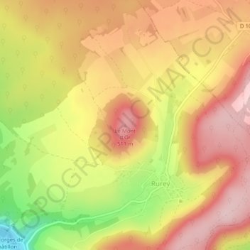
Name: Le Mont d'Or topographic map, elevation, terrain.
Average elevation: 1,411 ft
Minimum elevation: 948 ft
Maximum elevation: 1,703 ft
Other topographic maps
Click on a map to view its topography, its elevation and its terrain.
Cascade
France > Bourgogne-Franche-Comté > Doubs > Rurey
Cascade, Rurey, Besançon, Doubs, Bourgogne-Franche-Comté, France métropolitaine, 25290, France
Average elevation: 1,217 ft