
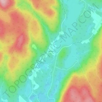
Val-Viger topographic map
Interactive map
Click on the map to display elevation.
About this map
Name: Val-Viger topographic map, elevation, terrain.
Average elevation: 1,040 ft
Minimum elevation: 787 ft
Maximum elevation: 1,427 ft
Other topographic maps
Click on a map to view its topography, its elevation and its terrain.
Barrage Kiamika
Canada > Québec > Antoine-Labelle > Chute-Saint-Philippe
Barrage Kiamika, Chute-Saint-Philippe, Antoine-Labelle, Laurentides, Québec, Canada
Average elevation: 945 ft
Réservoir Kiamika
Canada > Québec > Antoine-Labelle > Chute-Saint-Philippe
Réservoir Kiamika, Chute-Saint-Philippe, Antoine-Labelle, Laurentides, Québec, Canada
Average elevation: 1,158 ft
Lac Doré
Canada > Québec > Antoine-Labelle > Chute-Saint-Philippe
Lac Doré, Chute-Saint-Philippe, Antoine-Labelle, Laurentides, Québec, Canada
Average elevation: 1,188 ft