
Bergom topographic map
Interactive map
Click on the map to display elevation.
About this map
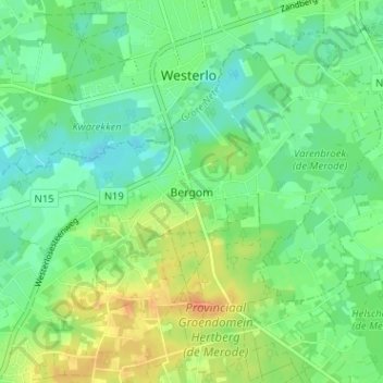
Name: Bergom topographic map, elevation, terrain.
Location: Bergom, Herselt, Turnhout, Antwerpen, Vlaanderen, 2230, België (51.05451 4.89737 51.09451 4.93737)
Average elevation: 59 ft
Minimum elevation: 10 ft
Maximum elevation: 135 ft
Other topographic maps
Click on a map to view its topography, its elevation and its terrain.