Geolocate

Redcliffe topographic map

Click on the map to display elevation.

About this map

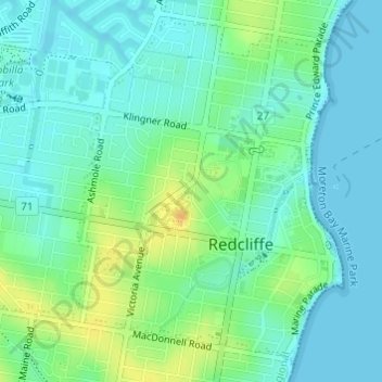
Name: Redcliffe topographic map, elevation, terrain.

Location: Redcliffe, Moreton Bay Regional, Queensland, Australia (-27.23885 153.09625 -27.21416 153.11780)

Average elevation: 30 ft

Minimum elevation: -3 ft

Maximum elevation: 92 ft

Gear up for your next adventure:

🧥Waterproof Jacket for Hiking - Breathable and rugged rain jacket for outdoor excursions
🧤Tactile Hiking Gloves - Keep hands warm while operating GPS and smartphone screens
🧷Carabiner Set - Durable clips for gear attachment
📷Action Cameras - Rugged cameras to document your journeys across rugged terrain
🥾Men's Hiking Boots - Durable, waterproof footwear for rugged terrain and steep inclines

As an Amazon Associate, this site earns from qualifying purchases at no extra cost to you.