
Aïn Zada topographic map
Interactive map
Click on the map to display elevation.
About this map
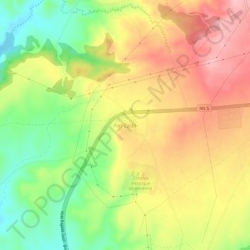
Name: Aïn Zada topographic map, elevation, terrain.
Location: Aïn Zada, Aïn Arnat, Daïra Aïn Arnat, Sétif, Algérie (36.14625 5.18418 36.18625 5.22418)
Average elevation: 3,048 ft
Minimum elevation: 2,785 ft
Maximum elevation: 3,291 ft