
The Sugarloaf topographic map
Interactive map
Click on the map to display elevation.
About this map
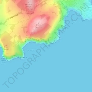
Name: The Sugarloaf topographic map, elevation, terrain.
Location: The Sugarloaf, Rushen, Isle of Man (54.05982 -4.76035 54.06008 -4.75986)
Average elevation: 128 ft
Minimum elevation: 0 ft
Maximum elevation: 545 ft