
Colcap topographic map
Interactive map
Click on the map to display elevation.
About this map
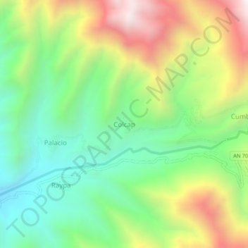
Name: Colcap topographic map, elevation, terrain.
Location: Colcap, Huanchay, Provincia de Huaraz, Áncash, Perú (-9.75520 -77.89144 -9.71520 -77.85144)
Average elevation: 5,571 ft
Minimum elevation: 3,976 ft
Maximum elevation: 8,071 ft