
Sarrat topographic map
Interactive map
Click on the map to display elevation.
About this map
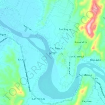
Name: Sarrat topographic map, elevation, terrain.
Location: Sarrat, Ilocos Norte, Ilocos Region, 2914, Philippines (18.11684 120.60435 18.19684 120.68435)
Average elevation: 151 ft
Minimum elevation: 16 ft
Maximum elevation: 965 ft