
Könnern topographic map
Interactive map
Click on the map to display elevation.
About this map
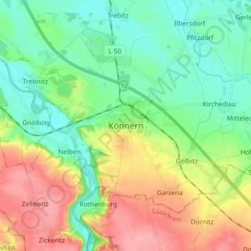
Name: Könnern topographic map, elevation, terrain.
Location: Könnern, Salzlandkreis, Saxe-Anhalt, 06420, Allemagne (51.63065 11.73137 51.71065 11.81137)
Average elevation: 331 ft
Minimum elevation: 200 ft
Maximum elevation: 554 ft