
Lütjenburg topographic map
Interactive map
Click on the map to display elevation.
About this map
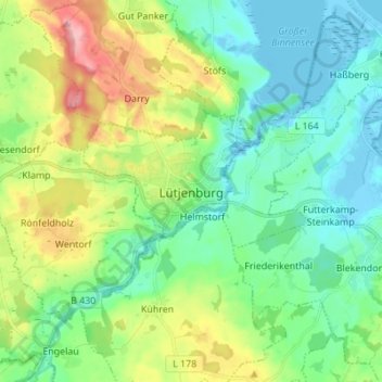
Name: Lütjenburg topographic map, elevation, terrain.
Location: Lütjenburg, Plön, Sleeswijk-Holstein, 24321, Duitsland (54.25283 10.55055 54.33283 10.63055)
Average elevation: 128 ft
Minimum elevation: -23 ft
Maximum elevation: 427 ft