
Thale topographic map
Interactive map
Click on the map to display elevation.
About this map
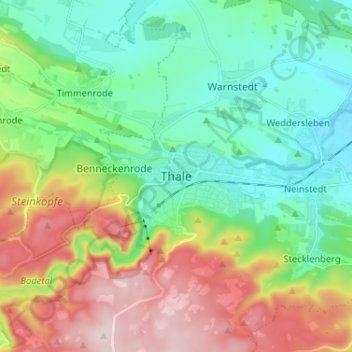
Name: Thale topographic map, elevation, terrain.
Location: Thale, Landkreis Harz, Saksen-Anhalt, 06502, Duitsland (51.71276 10.99772 51.79276 11.07772)
Average elevation: 850 ft
Minimum elevation: 427 ft
Maximum elevation: 1,650 ft