Refuge de l'Onda topographic map
Interactive map
Click on the map to display elevation.
About this map
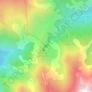
Name: Refuge de l'Onda topographic map, elevation, terrain.
Average elevation: 4,941 ft
Minimum elevation: 3,333 ft
Maximum elevation: 7,070 ft

Click on the map to display elevation.
Name: Refuge de l'Onda topographic map, elevation, terrain.
Average elevation: 4,941 ft
Minimum elevation: 3,333 ft
Maximum elevation: 7,070 ft