
Daïra Saïda topographic map
Interactive map
Click on the map to display elevation.
About this map
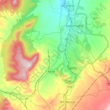
Name: Daïra Saïda topographic map, elevation, terrain.
Location: Daïra Saïda, Saïda, Algérie (34.78766 0.07043 34.90029 0.21446)
Average elevation: 2,946 ft
Minimum elevation: 2,293 ft
Maximum elevation: 3,937 ft
Other topographic maps
Click on a map to view its topography, its elevation and its terrain.