
Santa Teresita topographic map
Interactive map
Click on the map to display elevation.
About this map
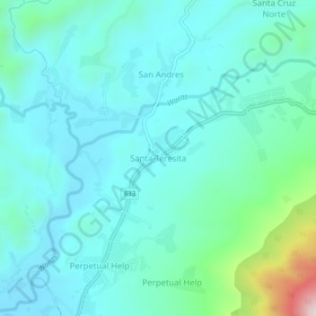
Name: Santa Teresita topographic map, elevation, terrain.
Location: Santa Teresita, Camarines Sur, Bicol Region, Philippines (13.46053 123.40068 13.50053 123.44068)
Average elevation: 446 ft
Minimum elevation: 105 ft
Maximum elevation: 2,136 ft