Geolocate

Port Louis topographic map

Click on the map to display elevation.

About this map

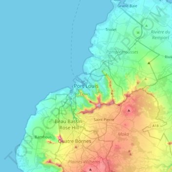
Name: Port Louis topographic map, elevation, terrain.

Location: Port Louis, 11317, Mauritius (-20.32245 57.34280 -20.00245 57.66280)

Average elevation: 466 ft

Minimum elevation: 0 ft

Maximum elevation: 2,451 ft

Gear up for your next adventure:

🖼️Topo Map Wall Art - Decorative topographic prints of famous peaks and regions
🌡️Handheld Weather Meters - Measure wind, temp, and pressure for safe mountain travel
🥩Freeze-Dried Meals - Nutritious and lightweight food for remote expeditions
Backpacking Tent - Lightweight and durable tent for multi‑day hikes
📷Action Cameras - Rugged cameras to document your journeys across rugged terrain

As an Amazon Associate, this site earns from qualifying purchases at no extra cost to you.