
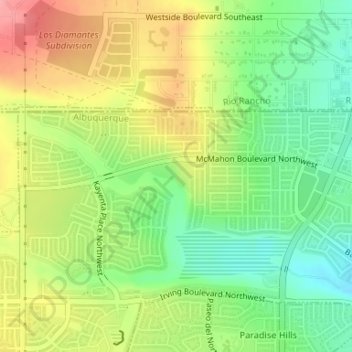
Joe M. Lucero Hillside topographic map
Interactive map
Click on the map to display elevation.
About this map
Name: Joe M. Lucero Hillside topographic map, elevation, terrain.
Average elevation: 5,371 ft
Minimum elevation: 5,226 ft
Maximum elevation: 5,538 ft
Other topographic maps
Click on a map to view its topography, its elevation and its terrain.
Sandia Heights
United States > New Mexico > Bernalillo County > Albuquerque
Sandia Heights, Albuquerque, Bernalillo County, New Mexico, 87111, United States
Average elevation: 6,227 ft
Tramway Highpoint (HOA)
United States > New Mexico > Bernalillo County > Albuquerque
Tramway Highpoint (HOA), Albuquerque, Bernalillo County, New Mexico, 87111, United States
Average elevation: 5,978 ft
Albuquerque
United States > New Mexico > Bernalillo County > Albuquerque
Albuquerque, Bernalillo County, New Mexico, 87102, United States
Average elevation: 5,482 ft
Glenwood Hills
United States > New Mexico > Bernalillo County > Albuquerque
Glenwood Hills, Albuquerque, Bernalillo County, New Mexico, 87111, United States
Average elevation: 6,355 ft
Oso Grande
United States > New Mexico > Bernalillo County > Albuquerque
Oso Grande, Albuquerque, Bernalillo County, New Mexico, 87111, United States
Average elevation: 5,696 ft