
Ängelholms kommun topographic map
Interactive map
Click on the map to display elevation.
About this map
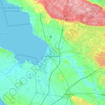
Name: Ängelholms kommun topographic map, elevation, terrain.
Location: Ängelholms kommun, Skåne County, Sweden (56.12658 12.64921 56.37813 13.19936)
Average elevation: 144 ft
Minimum elevation: -3 ft
Maximum elevation: 738 ft