Geolocate

Birdsville topographic map

Click on the map to display elevation.

About this map

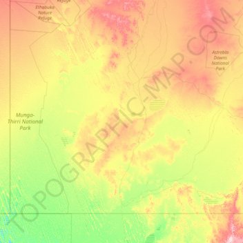
Name: Birdsville topographic map, elevation, terrain.

Location: Birdsville, Diamantina Shire, Queensland, Australia (-25.99686 137.99863 -23.97584 140.93786)

Average elevation: 259 ft

Minimum elevation: 39 ft

Maximum elevation: 804 ft

Gear up for your next adventure:

🔭Compact Binoculars - HD vision for scouting terrain and identifying distant landmarks
🎒Trekking Poles - Sturdy poles for balance and stability on rough terrain
🗻Climbing Gear Basics - Essential gear for beginner climbers
Camping Coffee Makers - Enjoy premium coffee at the summit or campsite
🪓Survival Multi‑Tool - Versatile tool for camp and trail tasks

As an Amazon Associate, this site earns from qualifying purchases at no extra cost to you.